Tuesday, March 27, 2012
Red Rock Canyon Nevada
On March 25th, we toured the Red Rock Canyon in Nevada. It's about 60 miles west of Las Vegas. The red rock formations in the area are very picturesque. The area is populated by wild burrows, and wild horses. we did encounter two wild burrows, but couldn't get the camera out in time to take a picture. See some of our photos:
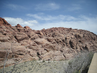
Red Rock Canyon
Red Rock Canyon National Conservation Area in Nevada is an area managed by the Bureau of Land Management as part of its National Landscape Conservation System, and protected as a National Conservation Area. It is located about 15 miles (24 km) west of Las Vegas, and easily seen from the Las Vegas Strip. The area is visited by over 1 million visitors each year.
La Madre Mountain seen from Griffith Peak
The conservation area showcases a set of large red rock formations: a set of sandstone peaks and walls called the Keystone Thrust. The walls are up to 3,000 feet (910 m) high, making them a popular hiking and rock climbing destination. The highest point is La Madre Mountain, at 8,154 feet (2,485 m).
A one-way loop road, 13 miles (21 km) long, provides vehicle access to many of the features in the area. Several side roads and parking areas allow access to many of the trails located in the area. A visitor center is located at the start of the loop road. The loop road is very popular for bicycle touring; it begins with a moderate climb, then is mostly downhill or flat.
Red Rock Canyon itself is a side-canyon accessible only by four-wheel-drive road off of the scenic loop. The unnamed but often visited valley cut through by State Route 159 is commonly, but incorrectly, referred to as Red Rock Canyon. The massive wall of rock called the Wilson Cliffs, or Keystone Thrust, can be seen to the west along this highway.
Towards the southern end of the National Conservation Area are Spring Mountain Ranch State Park, the western ghost town replica attraction of Bonnie Springs, and the village of Blue Diamond. The conservation area is one of the easternmost parts of the Mojave Desert; the lowest elevation of the area, from 3,600 to 4,500 feet (1,100 to 1,400 m), is in the Lower Sonoran Zone, while the area from 4,500 feet (1,400 m) up is in the Upper Sonoran Zone. The character of the sandstone layers is such that a number of year-round springs may be found in the recesses of the side canyons.
Some 600 species of plants are known in the area. Common types in the valley floor include the Joshua tree, Mojave yucca, banana yucca, creosote, and blackbrush. Higher up the Utah juniper and Sonoran scrub oak. (also called scrub live oak) come to dominate. Agave is easy to spot in red rock niches, with its thick low leaves and flowering stem that reaches twice the height of a man. The Calico Tanks trail has a plaque about prehistoric agave roasting pits. Ponderosa pines may be found at the top of the valley, where it connects to the Spring Mountains.
Wild burros are a familiar sight, as are rabbits and ground squirrels. Desert bighorn sheep are occasionally seen at higher elevations. During rare spring and summer rainstorms, tiny red-spotted toads can be seen emerging from pools of water.
The Conservation Area is protected habitat for the Desert Tortoise. A mascot tortoise, named Mojave Max, was kept at the Visitors Center. The Las Vegas Review-Journal reported on July 2, 2008 that Max had died of natural causes at the age of 65. A successor has not been named.
An outcrop of Aztec Sandstone
The Red Rock Area has a complex geological history, which over millions of years, helped to create the dramatic landscape that characterizes the region.
The Red Rock area was located under a deep ocean basin during the Paleozoic Era 600 million years ago. Sediments up to 9,000 feet thick were deposited, and eventually lithified. This sediment eventually formed into limestone.
Calico Hills scenery in Red Rock Canyon
Sunset at Red Rock Canyon
Around the Mesozoic Era 250 million years ago, the earth's crust started to rise due to tectonic shifts, forcing the water out and leaving behind evaporite formations of salt and gypsum. Exposure of the former sea bed allowed some of the rocks to oxidize (literally rust) and formed the area's characteristic red and orange rock layers.
Eventually a lush plain with streams and trees developed in the area. Some of these trees were covered with mud from the streams and eventually became petrified wood. Many of these fossilized logs can still be found today at the base of the Wilson Cliffs.
By 180 million years ago, the climate continued to change and the area became a desert featuring vast expanses of huge shifting sand dunes. These dunes would pile up and were lithified, and are now called Aztec Sandstone. During a mountain building period called the Laramide orogeny around 65 million years ago, the Keystone Thrust Fault developed, which ran through most of North America and through the Red Rock Conservation Area. The movement of this fault forced the older grey sedimentary rock over the younger red rocks, forming the striking red line that can be seen in the mountain today.
Death Valley California
On March 25th, we visited Death Valley California. We got a chance to visit the Badwater Area. This area is some 282 feet below sea level. It consists mostly of salt and borax. See the white surface of the desert. This is one of the hottest places on earth. We encountered a fox, or coyote that approached our vehicle, so we took a few photos.
Death Valley
Death Valley is a desert valley located in Eastern California. Situated within the Mojave Desert, it features the lowest, driest, and hottest locations in North America. Badwater, a basin located in Death Valley, is the specific location (36° 15' N 116° 49.5' W) of the lowest elevation in North America at 282 feet (86 m) below sea level. This point is only 84.6 miles (136.2 km) ESE of Mount Whitney, the highest point in the contiguous United States with an elevation of 14,505 feet (4,421 m). Death Valley holds the record for the highest reliably reported temperature in the Western hemisphere, 134 °F (56.7 °C) at Furnace Creek on July 10, 1913, just short of the world record, 136 °F (57.8 °C) in 'Aziziya, Libya, on September 13, 1922. However, the record high still remains the hottest July temperature ever recorded.
Located near the border of California and Nevada, in the Great Basin, east of the Sierra Nevada mountains, Death Valley constitutes much of Death Valley National Park and is the principal feature of the Mojave and Colorado Deserts Biosphere Reserve. It is located mostly in Inyo County, California. It runs from north to south between the Amargosa Range on the east and the Panamint Range on the west; the Sylvania Mountains and the Owlshead Mountains form its northern and southern boundaries, respectively. It has an area of about 3,000 sq mi (7,800 km2). Death Valley shares many characteristics with other places below sea level.
Death Valley Sand Dunes
Death Valley is one of the best geological examples of a basin and range configuration. It lies at the southern end of a geological trough known as Walker Lane, which runs north into Oregon. The valley is bisected by a right lateral strike slip fault system, represented by the Death Valley Fault and the Furnace Creek Fault. The eastern end of the left lateral Garlock Fault intersects the Death Valley Fault. Furnace Creek and the Amargosa River flow through the valley but eventually disappear into the sands of the valley floor.
Death Valley also contains salt pans. According to current geological consensus, during the middle of the Pleistocene era there was a succession of inland seas (collectively referred to as Lake Manly) located where Death Valley is today. As the area turned to desert the water evaporated, leaving behind the abundance of evaporitic salts such as common sodium salts and borax, which were subsequently exploited during the modern history of the region, primarily 1883 to 1907.
Dunes at Death Valley, looking east towards Nevada.
As a general rule, lower altitudes tend to have higher temperatures where the sun heats the ground and that heat is then radiated upward, but as the air begins to rise it is trapped by (1) the surrounding elevation and (2) the weight of the air (essentially the atmospheric pressure) above it. The atmospheric pressure is higher at very low altitudes than it is under the same conditions at sea level because there is more air (more distance) between the ground and the top of the atmosphere. This pressure traps the heat near the ground, and also creates wind currents that circulate very hot air, thereby distributing the heat to all areas, regardless of shade and other factors.
This process is especially important in Death Valley as it provides its specific climate and geography. The valley is surrounded by mountains, while its surface is mostly flat and devoid of plants, and of which a high percentage of the sun's heat is able to reach the ground, absorbed by soil and rock. When air at ground level is heated, it begins to rise, moving up past steep high mountain ranges, which then cools slightly, sinking back down towards the valley more compressed. This air is then reheated by the sun to a higher temperature, moving up the mountain again, whereby the air moves up and down in a circular motion in cycles, similar to how a convection oven works, albeit a natural one. This superheated air increases ground temperature markedly, forming the hot wind currents that are trapped by atmospheric pressure and mountains, thus stays mostly within the valley. Such hot wind currents contribute to perpetual drought-like conditions in Death Valley and prevent much cloud formation to pass through the confines of the valley, where precipitation is often in the form of a virga. Death Valley holds temperature records because it has an unusually high number of factors that lead to high atmospheric temperatures.
Death Valley in bloom.
The depth and shape of Death Valley influence its summer temperatures. The valley is a long, narrow basin 282 feet (86 m) below sea level, yet is walled by high, steep mountain ranges. The clear, dry air and sparse plant cover allow sunlight to heat the desert surface. Summer nights provide little relief as overnight lows may only dip into the 82 to 98 °F (28 to 37 °C) range. Moving masses of super-heated air blow through the valley creating extreme high temperatures.
The hottest air temperature ever recorded in Death Valley (Furnace Creek) was 134 °F (57 °C) on July 10, 1913, at Furnace Creek, which is currently the hottest temperature ever recorded in the western hemisphere. During the heat wave that peaked with that record, five consecutive days reached 129 °F (54 °C) or above. The greatest number of consecutive days with a maximum temperature of 100 °F (38 °C) or above was 154 days in the summer of 2001. The summer of 1996 had 40 days over 120 °F (49 °C), and 105 days over 110 °F (43 °C). The summer of 1917 had 52 days where temperatures reached 120 °F (49 °C) or above with 43 of them consecutive. Four major mountain ranges lie between Death Valley and the ocean, each one adding to an increasingly drier rainshadow effect, and in 1929 and 1953 no rain was recorded for the whole year. The period from 1931 to 1934 was the driest stretch on record with only 0.64 inches (16 mm) of rain over a 40-month period.
A Greater Roadrunner at the Death Valley National Park Visitor Center in California.
The mean annual temperature for Death Valley (Furnace Creek Weather Station) is 77.2 °F (25.1 °C) with an average high in January of around 67 °F (19 °C) and 116 °F (47 °C) in July. From 1934-1961 the weather station at Cow Creek recorded a Mean Annual Temperature of 77.2 °F (25.1 °C)°F.
The period from July 17–19, 1959, was the longest string of consecutive days where nighttime low temperatures did not drop below 100 °F (38 °C). The highest-ever nighttime low temperature in Death Valley was 103 °F (39 °C) recorded on July 5, 1970, and July 24, 2003.
The longest number of consecutive days where temperatures reached 90 °F (32 °C) or more was 205 during Apr-Oct 1992. On average there are 192 days per year in Death Valley where temperatures reach 90°F (32°C) or more.
The lowest temperature recorded at Greenland Ranch was 15 °F (−9 °C) in January 1913.
The average annual precipitation in Death Valley is 2.36 inches (60 mm), while the Greenland Ranch station averaged 1.58 inches (40 mm). The wettest month on record is January 1995 when 2.59 inches (66 mm) fell on Death Valley. The wettest period on record was mid 2004 to mid 2005, in which nearly 6 inches (150 mm) of rain fell in total, leading to ephemeral lakes in the valley and the region and tremendous wildflower blooms. Snow with accumulation has only been recorded in January 1922, while scattered flakes have been recorded in other occasions.
Las Vegas
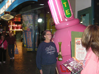
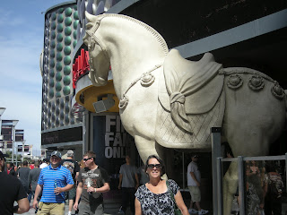
On March 23rd, we visited Las Vegas. Everything you hear about Vegas, and it's nightlife is true. We forgot to take into account, that it was March break, and also March madness (college basketball playoffs).Therefore the streets were very crowded, as well as all the venues. We couldn't find a room in Vegas, so we had to drive 60 miles out of town to get a room. Nevertheless, we managed to find a roon on the strip for the second night.
We did at least a dozen casinos, from Ceasars Palace, the Bellagio, to the MGM Grand. We did the Fremont Street Experience in old Vegas. Before arriving in Vegas we took a side trip to the Hoover Dam.
Las Vegas is the most populous city in the U.S. state of Nevada and the county seat of Clark County. Las Vegas is an internationally renowned major resort city for gambling, shopping, and fine dining. The city bills itself as The Entertainment Capital of the World, and is famous for its consolidated casino–hotels and associated entertainment. A growing retirement and family city, Las Vegas is the 28th-most populous city in the United States, with a population at the 2010 census of 583,756. The 2010 population of the Las Vegas metropolitan area was 1,951,269.
Established in 1905, Las Vegas was incorporated as a city in 1911. At the close of the 20th century, Las Vegas was the most populous American city founded in that century (a distinction held by Chicago in the 19th century). The city's tolerance for various forms of adult entertainment earned it the title of Sin City, and this image has made Las Vegas a popular setting for films and television programs. There are numerous outdoor lighting displays on Fremont Street, as well as elsewhere in the city.
The name Las Vegas is often applied to unincorporated areas that surround the city, especially the resort areas on and near the Las Vegas Strip. The 4.2 mi (6.8 km) stretch of Las Vegas Boulevard known as the Strip is mainly in the unincorporated communities of Paradise, Winchester, and Enterprise.
Hoover Dam
Hoover Dam, once known as Boulder Dam, is a concrete arch-gravity dam in the Black Canyon of the Colorado River, on the border between the US states of Arizona and Nevada. It was constructed between 1931 and 1936 during the Great Depression and was dedicated on September 30, 1935, by President Franklin Roosevelt. Its construction was the result of a massive effort involving thousands of workers, and cost over one hundred lives. The dam was controversially named in honor of President Herbert Hoover.
Since about 1900, the Black Canyon and nearby Boulder Canyon had been investigated for their potential to support a dam that would control floods, provide irrigation water and produce hydroelectric power. In 1928, Congress authorized the project. The winning bid to build the dam was submitted by a consortium called Six Companies, Inc., which began construction on the dam in early 1931. Such a large concrete structure had never been built before, and some of the techniques were unproven. The torrid summer weather and the lack of facilities near the site also presented difficulties. Nevertheless, Six Companies turned over the dam to the federal government on March 1, 1936, more than two years ahead of schedule.
Hoover Dam impounds Lake Mead, and is located near Boulder City, Nevada, a municipality originally constructed for workers on the construction project, about 25 mi (40 km) southeast of Las Vegas, Nevada. The dam's generators provide power for public and private utilities in Nevada, Arizona, and California. Hoover Dam is a major tourist attraction; nearly a million people tour the dam each year. Heavily travelled U.S. 93 ran along the dam's crest until October 2010, when the Hoover Dam Bypass opened.
Subscribe to:
Posts (Atom)