Sunday, January 29, 2012

Tombstone

We spent a day visiting the city of Tombstone, with sites like the renowned Boot Hill Cemetary, and the OK Corral. This was the town made famous by Wyatt Earp. It was also the site for many western films with the likes of John Wayne and Matt Dillon. It has old western sidewalks and streets with saloons and cowboy gunfights in the streets. I also got a chance to shoot a six gun at a shooting gallery. It was awsome! Here are a few pictures:

Boothill Graveyard


Graves of Billy Clanton, Frank McLaury, and Tom McLaury in Boothill Graveyard, Tombstone, Arizona.
The most notable use of the name Boot Hill is at the Boothill Graveyard (or Cemetery) in Tombstone, Arizona. 31°43′11. Formerly called The Tombstone Cemetery, the plot features the graves of Billy Clanton, Frank McLaury and Tom McLaury; the three men were killed during the famed Gunfight at the O.K. Corral.

Located on the northwest corner of the town, the graveyard is believed to hold over 300 persons, 205 of which are recorded. This was due to some people (especially Chinese and Jewish immigrants) being buried without record. There is a separate Jewish cemetery nearby with some markers restored, and there are also marked graves of Chinese. However, most of the loss was due to neglect of grave markers and theft of these wooden relics as souvenirs. For example, when former Tombstone Mayor John Clum visited Tombstone for the first Helldorado celebration in 1929, he was unable to locate the grave of his wife Mary, who had been buried in Boothill.

The Tombstone "boothill" cemetery was closed in late 1884, as the new "City Cemetery" on Allen Street opened. Thereafter, Boothill was referred to as the "old city cemetery" and neglected. It was used after that only to bury a few later outlaws (some legally hanged and one shot in a robbery), as well as a few colorful Western characters and one man (Emmett Crook Nunnally) who had spent many volunteer hours restoring it.

Currently the Tombstone "Boothill Graveyard" is open to the public without fee, and is a popular stop for tourists visiting Tombstone.


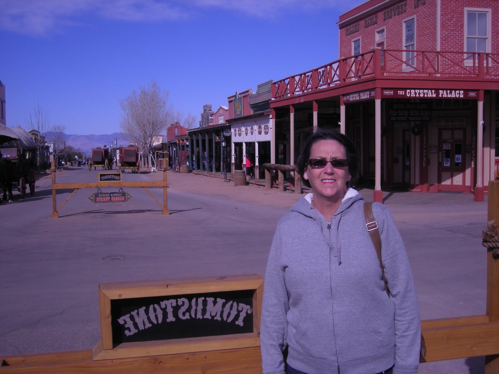
Tombstone is a city in Cochise County, Arizona, United States, founded in 1879 by Ed Schieffelin in what was then Pima County, Arizona Territory. It was one of the last wide-open frontier boomtowns in the American Old West. From about 1877 to 1890, the town's mines produced USD $40 to $85 million in silver bullion, the largest productive silver district in Arizona. Its population grew from 100 to around 14,000 in less than 7 years. In 1881, it became the county seat of the new Cochise County.


Far distant from any other metropolitan city, by mid-1881 Tombstone boasted a bowling alley, four churches, an ice house, a school, two banks, three newspapers, and an ice cream parlor, alongside 110 saloons, 14 gambling halls, and numerous dancing halls and brothels.[citation needed] All of these were situated among and on top of a large number of dirty, hardscrabble mines. The gentlemen and ladies of Tombstone attended operas presented by visiting acting troupes at the Schieffelin Hall opera house, while the miners and Cowboys saw shows at the Bird Cage Theatre, "the wildest, wickedest night spot between Basin Street and the Barbary Coast."


Under the surface were tensions that grew into deadly conflict. Many of the Cowboys were Confederate sympathizers and Democrats. The capitalists and townspeople were largely Republicans from the Northern states. The fast-growing city, only 30 miles (48 km) from the U.S./Mexico border, was a wide-open market for beef stolen from ranchos in Sonora, Mexico by the outlaw Cowboys. These men were a loosely organized band of friends and acquaintances who teamed up for various crimes and came to each others aid.


The Earp brothers—Virgil, Wyatt, Morgan and Warren Earp—arrived in December 1879 and the summer of 1880. All assumed roles as lawmen at one time or another which led to ongoing conflicts with Ike and Billy Clanton, Frank and Tom McLaury, and other Cowboys. After repeated threats against the Earps by the Cowboys over many months, the conflict escalated into a confrontation that turned into a shoot out, the now-famous Gunfight at the O.K. Corral.


In the mid-1880s, the silver mines penetrated the water table and despite significant investments in pumps, mining operations were unable to continue. Its economy today is based on tourism. The city's population dwindled to a low of about 800 in the early 20th century but has stabilized at about 1500 residents. According to 2006 Census Bureau estimates, the population of the city was 1,569.

San Xavier Mission

We had an opportunity to visit Tucson in late January. One of the sites we visited was the San Xavier Mission. Here are a few photos:


A National Historic Landmark, San Xavier Mission was founded as a Catholic mission by Father Eusebio Kino in 1692. Construction of the current church began in 1783 and was completed in 1797.


The oldest intact European structure in Arizona, the church's interior is filled with marvelous original statuary and mural paintings. It is a place where visitors can truly step back in time and enter an authentic 18th Century space.


The church retains its original purpose of ministering to the religious needs of its parishioners.


The Mission is 9 miles south of downtown Tucson, Arizona just off of Interstate 19. Take exit 92 (San Xavier Road) and follow signs to the Mission.


There is no admission charge to visit Mission San Xavier. Some 200,000 visitors come each year from all over the world to view what is widely considered to be the finest example of Spanish Colonial architecture in the United States.


The current church dates from the late 1700's, when Southern Arizona was part of New Spain. In 1783, Franciscan missionary Fr. Juan Bautista Velderrain was able to begin contruction on the present structure usin money borrowed from a Sonoran rancher. He hired an architect, Ignacio Gaona, and a large workforce of O'odham to create the present church.


Following Mexican independence in 1821, San Xavier became part of Mexico. The last resident Franciscan of the 19th Century departed in 1837. With the Gadsden Purchase of 1854, the Mission joined the United States. In 1859 San Xavier became part of the Diocese of Santa Fe. In 1866 Tucson became an incipient diocese and regular services were held at the Mission once again. Sisters of St. Joseph of Carondelet opened a school at the Mission in 1872. Franciscan Sisters of Christian Charity now teach at the school and reside in the convent.


The Franciscans returned to the Mission in 1913. Recently, Mission San Xavier became a seperate nonprofit entity. It remains a testament to the endurance of culture thoughtout our history.

Constructed of low-fire clay brick, stone and lime mortor, the entire structure is roofed with masonary vaults, making it unique among Spanish Colonial uildings within U. S. borders. The architect, Ignacio Gaona, is credited with building another church in Caborca, Sonora Mexico.


Little is known about the people who decorated the interior. The artwork was problably commissioned by Fr. Velderrain's successor and most likely created by artists from Queretero in New Spain (now Mexico). The sculpture was created in guild workshops and carried by donkey through the Pimeria Alta to its destination at the Mission. Craftsmen created gessoed clothing once the sculpture was in place.


The church contains numerous references to the Franciscan cord both on the facade and throughout the church.


The shell, a symbol of pilgrimage after the patron saint of Spain, Santiago or James the Greater, is replicated all through the structure in window treatments, the sanctuary, the facade and other details within the interior.


The Baroque architecture style features playful dramatic elements such as theatrical curtain displays, faux doors, marbleing, and overall sense of balance.

An earthquake in 1887 knocked down the mortuary wall and damaged parts of the church. Extensive repairs began in 1905, under Bishop Henry Granjon. The next round of restoration followed the years after 1939 when a lightening strike hit the West Tower lantern.


A group of community leaders formed the Patronanto San Xavier in 1978 to promote the conservation of Mission San Xavier. Shortly after a comprehensive study of its condition was completed, water seeped into the west wall of the church's sanctuary, forcing an emergency conservation effort by the Patronato. In a five-year program, an international team of conservators cleaned, removed over-painting, and repaired the interior painted and sculptured art of Mission San Xavier del Bac.


The Patronato continues exterior preservation work begun in 1989. Its restoration team is removing the earlier coating of cement plaster, repairing the historic brick beneath, and

re-finishing the exterior surface with a traditional lime plaster. The sooner the cement can be removed, the greater the amount of original fabric can be preserved. More remains to be done if we are to guarantee this landmark for future generations. Please help us preserve this national treasure.


Outside the church we had a chance to experience some of the Indian Fry Bread from one of the local vendors

Wednesday, January 18, 2012

The Ruins of Casa Grande

On January 17th 2012, we visited the ruins of Casa Grande,Just north of Coolidge. We took a few pictures of the ruins, as well as provide a bit of historical background to the ruins.


Casa Grande Ruins National Monument
This national monument, located south of Phoenix, contains the ruins of Casa Grande or "Great House," a large and enigmatic prehistoric structure. Casa Grande Ruins, the nation's first archeological preserve, protects the Casa Grande (see Photograph 1) and other archeological sites within its boundaries. While there are no prehistoric irrigation systems in the park, the museum presents excellent background information on the Hohokam canals which diverted water from the nearby Gila River. It is also speculated that one of the functions of Casa Grande was to provide an overlook from which the Hohokam could observe the status of their canals.
The park is located in Coolidge, Arizona, a one-hour drive from either Phoenix or Tucson. From Interstate 10 take the Coolidge exit and follow the signs to the park entrance off Arizona Route 87/287.


On the road to Arizona

On January 10th 2012, we began our trip to the US west coast via Arizona. We stayed at the Indian Skies RV Resort in Coolidge Arizona.


Elevation 1,400 feet. Station, 19 miles from Picacho, on Phoenix and Wellton Branch S.P.R.R. After President Calvin Coolidge. "Town established 1926, in the center of the area to be irrigated by waters impounded by the Coolidge Dam." Post office established June 14, 1926, Mrs Dora H. Nutt, Post Master. "Cooldige came into existence when Coolidge Dam was constructed, that fact making water available for irrigation. Both it and the dam were named for President Calvin Coolidge. The name was suggested by Richard J. Jones because President Coolidge's signature in 1924 had made the dam possible."


On the way to our destination we took several pictures in southern New Mexico as well as Arizona.